Related Content
Contact Person

Amanda Borup Pedersen
ESA BIC MANAGER, DTU
Get in touch
Contact Person

Poul zimmermann nielsen
ESA Technology broker, DTU
Get in touch


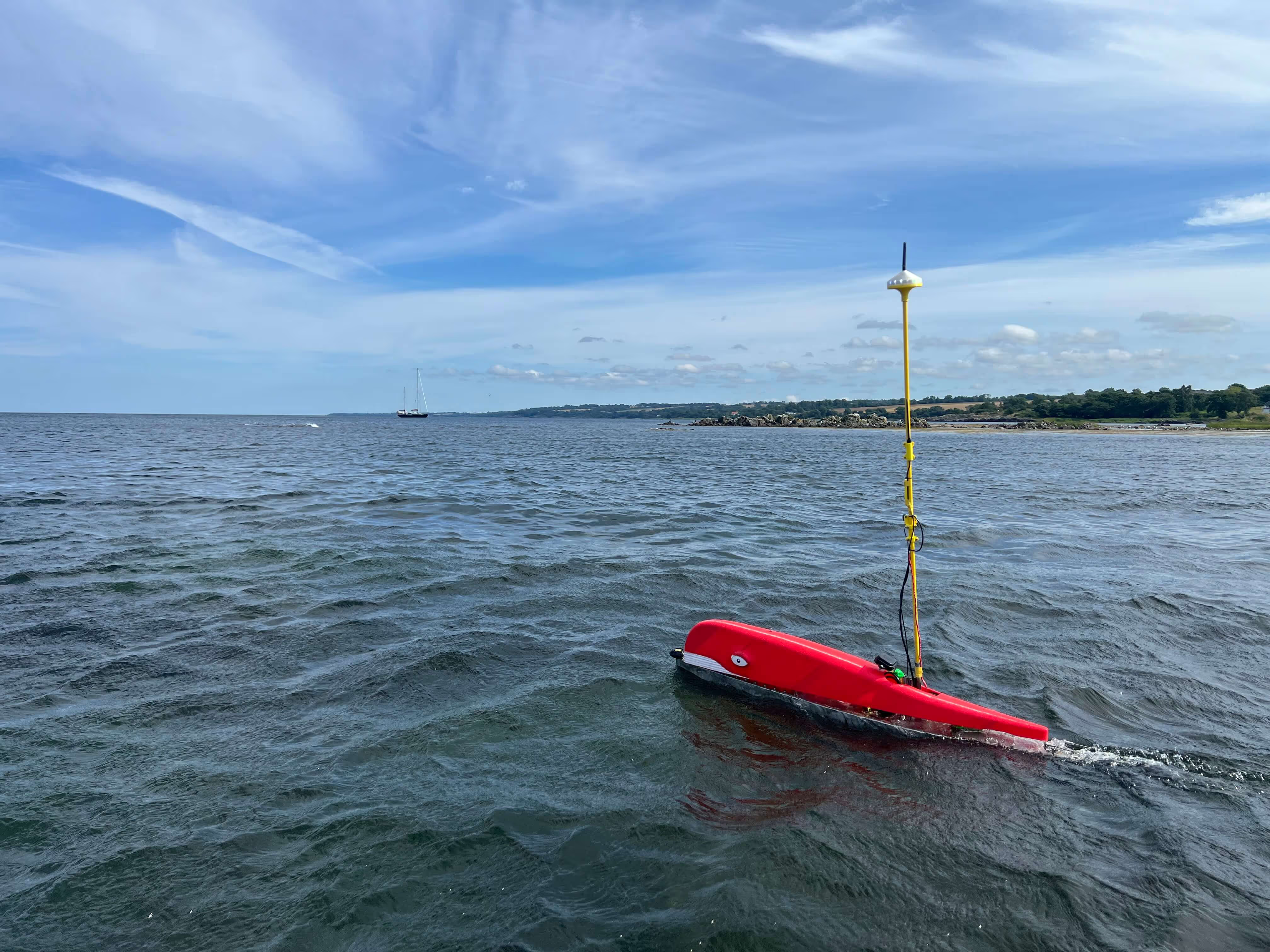
Sensemakers’ Unmanned Surface Vehicles (USVs) use GNSS positioning and mounted sensors to turn space data into environmental insight - helping us better understand what’s really happening in our oceans.
By combining satellite positioning data with USV-mounted sensors, Sensemakers supports cost-efficient, systematic, and baselined, time-based maritime environmental monitoring all year round. Evaluating water quality and tracing pollutants, as well as the effects of remediation work, their tools help researchers and authorities collect the data they need to create solutions or make decisions. Their work is particularly relevant to marine recreational environments and offshore monitoring.
Their specially equipped USVs – the SenseBoats – and dashboard solutions for accessing live data make high–quality environmental data collection at sea more efficient, more scalable, and more accessible.
The Earth’s oceans are changing fast; from pollution to the loss of biodiversity, we need better ways to monitor what is happening over time and across large areas of the oceans.
Sensemakers use of satellite positioning data allows the USV-mounted sensor measurements to be tied precisely to the location at which they were taken, delivering a broader, more complete picture of ocean health.
Their work has the possibility to support activities from climate research to regulatory reporting and, overall, helping to build the foundation that is needed for improved marine environments.
Sensemakers are showcasing how satellite technology can play a vital role in marine sustainability. Their solution is a strong example of innovative space tech in action – bridging space and Earth and supporting real-world solutions for maritime monitoring and protection.
ESA BIC and its Technology Brokers help companies like Sensemakers turn cutting-edge ideas into operational tools. Get in touch to discover how satellite data can strengthen your impact in the maritime.
